
High Point is the best bet close by to NYC. Upper Awosting trail at Minnewaska is on life support, attended to by groomers, but it’s still skiable.
If the ever-reliable Prospect Mountain is too routine, head to the Tug Hill areas or the southern Adirondacks. The Osceolas as well as Lapland Lake and Garnet Hill got several inches of snow and have the best conditions in the northeast aside from areas in the White Mountains like Jackson Ski Touring.
Let’s take a look at where the snow fell this weekend:
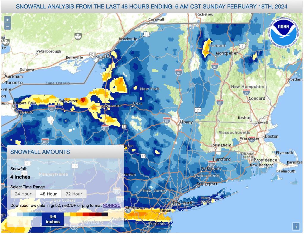
A narrow band of heavy accumulation landed just south of NYC, Meanwhile, very spotty snowfall up north dumped on some localities in northern New Yrok state and the northern Green Mountains, and left out most everywhere else,
This post is about conditions for Feb. 18, 2024, and forecast for the next few days. See jump links to Conditions and Forecast.
Conditions
‘Thin cover’ is a phrase repeated in many touring center reports for today. Some of the cover is on top of a firm or even icy base, which can hide some challenges or hazards. However, the places iwth top-notch grooming have kept the trails just loose enough that new snow can be groomed into the surface. Generlly this means good skate skiing. On the other hand, setting the proper depth of classic tracks becomes problematic on aa hard base with just a couple of inches of new snow on top.
Provided at least a few inches of new snow comes every week to keep the snowpack refreshed, and the temperatures don’t spike to the 40s for days on end, the season can keep going- it might not be superb, but it can be good or even very good at times.
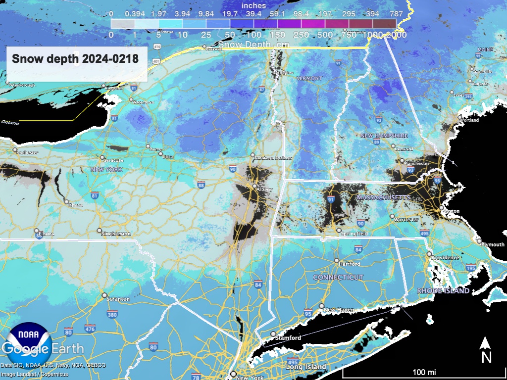
Hit up ‘State of the touring centers‘ or in the menu above for reported conditions as of today. Snow depth graphic below:
Forecast
Lake effect snow will continue to bring scattered snow showers across New York State and Vermont, and end in the early morning on Monday. Although accumulations will generally be slight, several inches could fall in certain localities.
Dry weather Tuesday and Wednesday, with high temperatures about or slightly above normal.
A ‘complex system’ from the midwest will brings precipitation for Thuesday and Friday, falling as a mix of rain, freezing rain, and snow depending on time of day and elevation. Accumulations if any are expected to be light. The system will move out by Saturday, as cooler air and gusty winds move into the region for the weekend.
A second fast-moving system comes through on Sunday, and should bring snow to the north country. Accumulations from this are also expected to be light.
A warming trend is anticipated following next weekend, but the 6-10 day outlook from the NOAA Climate Prediction Center projects near-normal temperature and precipitation, so there’s hope for continued winter weather.
| Daytime temps | Monday 2/19 | Tuesday 2/20 | Wednesday 2/21 | Thursday 2/22 | Friday 2/23 | Saturday 2/24 | Sunday 2/25 |
| Northern NY, VT, NH | Low 20s to low 30s | Mid 20s to mid 30s | Mid 30s to low 40s | Low 40s | High 30s to low 40ss | Mid 20s to low 30s | Mid 20s to mid 30s |
| NYC metro and coastal New England | Mid- to high-30s | High 30s | High 30s to low 40s | Mid 40s | Mid 40s | Mid 30s to low 40s | High 30s |
