
The Whistlepig persistence award goes to Minnewaska State Park, where the park employees take a few lucky inches of snow and groom the trails up.

Beyond Minnewaska, Notchview has good skiing, as do areas in Vermont at higher elevations. Areas in the southern Adirondacks are doing well, and it looks like the White Mountains is possibly the best of all. Grading is being done on the curve today- meaning there can be ‘Good skiing’ but with some thin spots or wet spots.
This post is about conditions for Feb. 2, 2023, and forecast for the next few days. See jump links to Conditions and Forecast.
Conditions
Maxiglide alert: Light scattered snow today in the north country and higher elevations, combined with spring skiing conditions, could make for some sticky wax pockets. Damp snow with or without new snow will also make for complex kick-wax decisions, and may make skating slow after things warm up.
Just enough snow has fallen in recent days to keep things freshened up. The wet snow of Monday/Tuesday stuck to tree branches and froze overnight in many places, maintaining a ‘winter wonderland’ effect for a few days, but that’s probably over except for higher elevations.
Wet snow or rain, plus the freeze/thaw cycles are degrading the snow quality toward klister conditions quickly. As weather cools off, look for more trails to be in ‘frozen granuilar’ conditions, if not ‘firm and fast’. Lack of snow in the forecast means we’ll be making do with the snow we have, or the snow the touring center can make. Backcountry trails in the High Peaks have thin cover that will be pretty hard shortly.
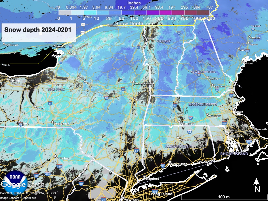
Hit up ‘State of the touring centers‘ or in the menu above for reported conditions as of today. Snow depth graphic below:
Forecast
For Groundhog Day, scattered light rain and snow showers across the region, Possibilty of snow is greatest in the north at elevations above 1000′, but in any case accumulations if any will be small. Some areas will get freezing rain, so be careful driving Friday evening. Generally cloudy weather for Friday will become partly sunny skies during the weekend and last through most of next week Temperatures cool off toward ‘normal’ for the weekend.
For the next several days a high will remain in place over the continental US, giving us a few days of dry and partly sunny eather. During next midweek a low in the Atlantic will pass by the northeast, but any precipitation is expected to occur out at sea. On the other hand, this is weather, and that could change.
Longer range forecasts indicate possible rain for the weekend of Feb. 10, but that’s still some time off and it’s too early to make any definite predictions.
| Daytime temps | Friday 2/2 | Saturday 2/3 | Sunday 2/4 | Monday 2/5 | Tuesday 2/6 | Wednesday 2/7 | Thursday 2/8 |
| Northern NY, VT, NH | 30s | High 20s to low 30s | High 20s to high 30s | Mid 20s to low 30s | High 20s to low 30s | 30s | Mid 30s to low 40s |
| NYC metro and coastal New England | High 30s to mid 40s | High 30s to low 40s | High 30s to mid 40s | High 30s tto low 40s | Mid 30s to low 40s | High 30s to low 40s | 40s |
