
It finally happened- firrst significant snowfall in NYC region in two years. Scant in the city melted rapidly, but several more inches fell just north and west of the metro region. Unfortunately we’ll have only a couple of days before rain degrades this snowpack, but we might see a bit of relief heading into next weekend.

Fahnestock reports 6″ and grooming limited trails; Highpoint reports 12″ new snow in the woods and will most likely open Monday and Tuesday; Minnewaska received about a foot of snow and has done limited packing of trails due to mechanical issues with maintenance equipment. Mohonk is grooming trails, and Shawangunk Nordic Ski Association plans to groom the OSI River to Ridge trail from New Paltz.
This post is about conditions for Jan. 7 2024, and forecast for the next few days. See jump links to Conditions and Forecast.
Conditions
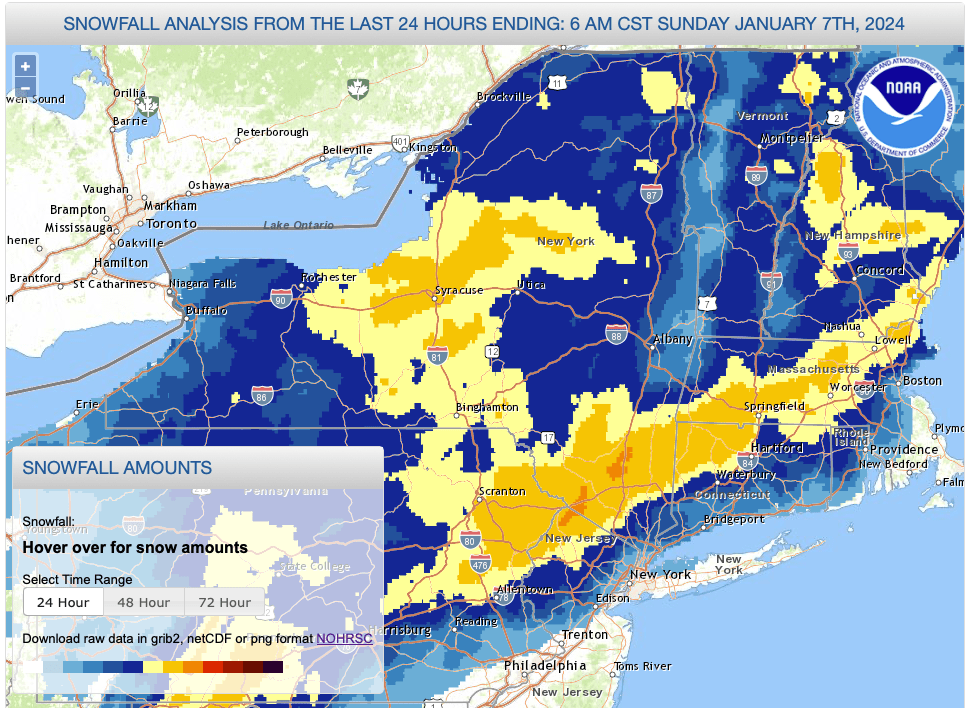
Heavy, wet snow across southern and western portions of the northeast, with fluffier snow in the White Mountains. Accumulation fell off inland and northward for this one. Boson suburbs got more than expected it seems. Due to the lack of cover, rock skis are generally recommended.
Get the skiing while you can, because a warm storm arrives midweek.

Hit up ‘State of the touring centers‘ or in the menu above for reported conditions as of today. Snowfall totals graphic shows conditions from early this morning, which leaves out the additional accumulation during the daytime Sunday:
Forecast
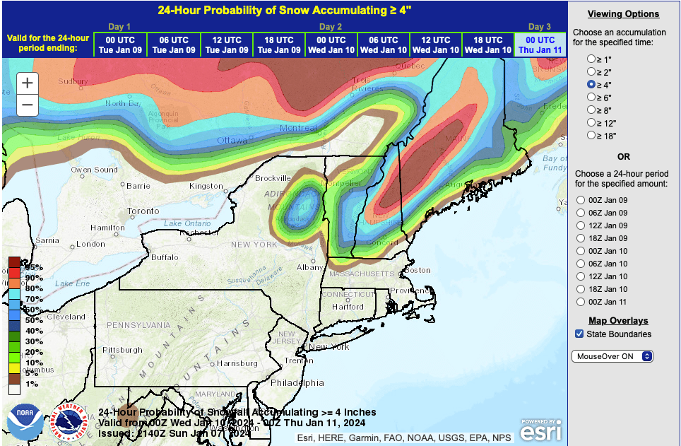
A significant weather system arrives Tuesday afternoon with high winds and rain. Unlike the previous storm, this one will track to the west of NYC and the Hudson Valley, and by Tuesday night heavy rain is expected across the region with the possible exception of higher elevations in the far north. The lower Hudson Valley and sNYC metro area could see or more inches during the night. The most likely places to avoid significant damage to the snowpack are the farthest northern areas and higher elevations of White Mountains and Maine.
There are modest chances for some accumulating snow in the Adirondacks, Green and White Mountains, and Maine late in the week and the first half of the weekend, as temperatures drop to more seasonable levels again. The big winner may be the Laurentians in Canada, where they may gain some real snow out of this coming week.
| Daytime temps | Monday 1/8 | Tuesday 1/9 | Wednesday 1/10 | Thursday 1/11 | Friday 1/12 | Saturday 1/13 | Sunday 1/14 |
| Northern NY, VT, NH | Upper 20s to low 30s | Mid 30s | 40s | 30s | 30s | 30s | 20s |
| NYC metro and coastal New England | Upper 30s to low 40s | Mid 40s to low 50s | Upper 40s to low 50s | 40s | 40s | Mid 40s to low 50s | 30s |
