
Upcoming storm for this weekend will result in a mostly-snow event for southern New York and New England. A second storm will arrive the middle of next week, and is likely to bring some snow but also heavy wind and rain.
This post is a weather watch for the weekend of Jan. 6 2024, and forecast for the next week For details hit the jump link or scroll to Forecast.
Conditions
Cascade Welcome Center trails are open with minimal skiing. The centers with the technical ‘snow-how’ (Mt van Hoevenberg Gore Mtn), luck (Rikert, Blueberry Lake, Great Glen), or combination of both (Garnet Hill, Craftsbury, JSTF) have been hard at work keeping some trails open. Hit up ‘State of the touring centers‘ or in the menu above for reported conditions as of today
Forecast
Classic nor’easter on the way for Saturday afternoon into Sunday, but near-freezing temps make it hard to predict where the rain/snow line will lie. NWS New York office is predicting heaviest snowfall just inland from the coast of southern NY and New England. We in the NYC metro could get a nice blanket of snow, or a coating of rain/wintry mix.
Slight differences in the track of the center of the low-pressure system will alter the snowfall amount as well as where the rain/snow line falls. Right now that line looks to be just south of Fahnestock and Minnewaska State Park, so it’s possible they’ll get enough snow to groom by Sunday.

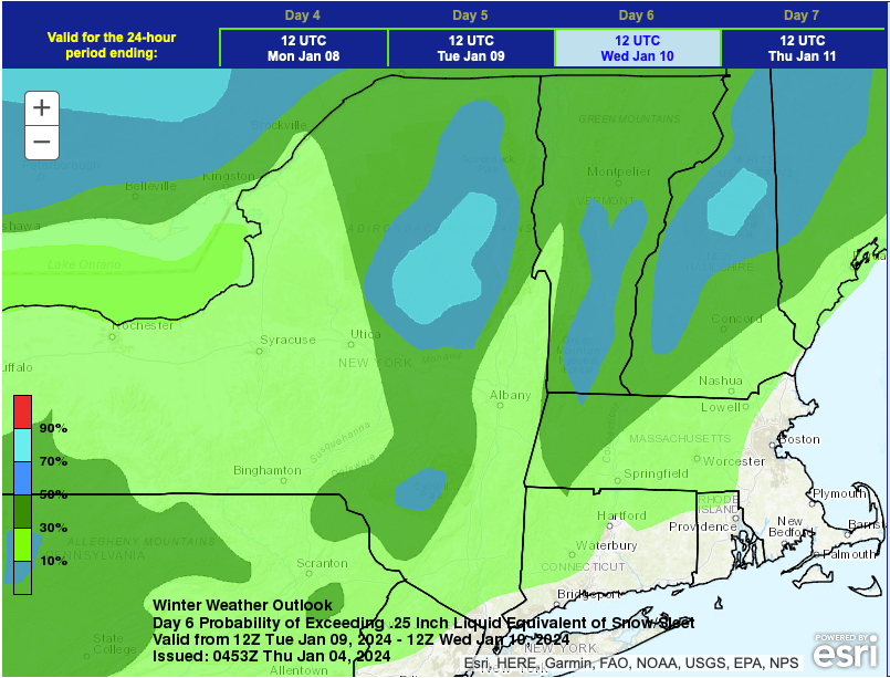
The weekend storm will move be gone by late Sunday. After a dry Monday, a storm coming up the Mississippi valley will arrive over Pennsylvania and western New York by Tuesday afternoon. This is a deep low-pressure system, so high winds will be a hazard. Early precipitation could fall as snow in some parts of the northeast, but will change over to rain.
Greatest likelihood for snow accumulation before it turns to rain will be the Adirondacks and White Mountains. There’s still some time and potential for a change towards more snow than rain, but that scenario isn’t very likely.
| Daytime temps | Friday 1/5 | Saturday 1/6 | Sunday 1/7 | Monday 1/8 | Tuesday 1/9 | Wednesday 1/10 |
| Northern NY, VT, NH | Mid- to uper-20s | Mid- to uper-20s | Mid- to uper-20s | Upper 20s to low 30s | Low- to mid-30s | Low- to mid-40s |
| NYC metro and coastal New England | Low- to upper-30s | Low 30s to low 40s | Low- to upper-30s | Mid 30s to low 40s | Upper 30s upper 40s | Mid 40s to low 50s |
