For skiers, unlucky weather conditions for the Tug Hill and Adirondacks reagion are balanced by some decent skiing in the far northern areas of Vermont and higher elevations of the White Mountains.
Rain for Sunday will change over to snow for the north country Sunday night. Accumulations could be signfificant in the hgher elevations.
This post is about conditions for Dec. 9, 2023, and forecast for the next few days. See jump links to Conditions and Forecast.
Conditions
Regionally speaking, East, North, and high is where the snow is. Great Glen Trails in the White Mountains, Craftsbury, and Trapp Family Lodge have skiable conditions.
BETA report of 12.9 hedges their bets pending the amount of snow for Sunday-Monday.
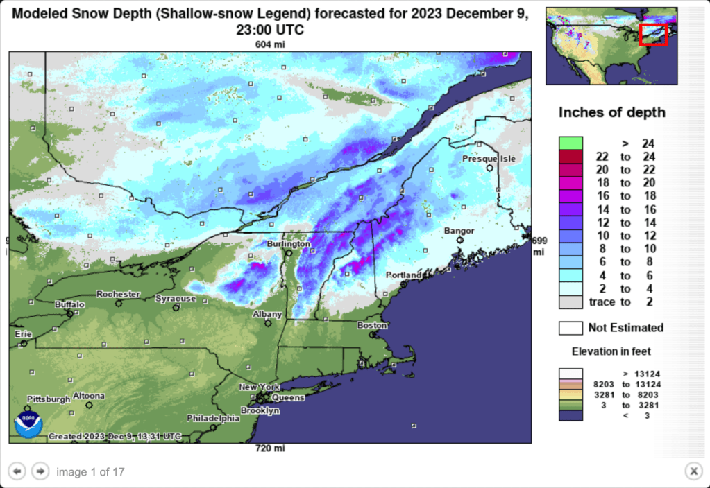
Hit up ‘State of the touring centers‘ or in the menu above for reported conditions as of today. Snow depth graphic below:
Forecast
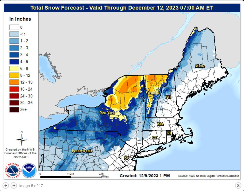
Precipitation moving through the region will begin as rain Sunday. By evening, it will likely convert to snow in the north country and higher elevations. Snow in those areas will continue into Monday. Driving could be hazardous Monday morning. The National Weather Service has called a winter storm watch for the Adirondacks, but the mroe serious winter storm warning for the mid- and norther Green Mountains.
The question is: how much snow? orecast snowfall totals by Monday evening for The Adirondacks is potentially 10″, while some isolated areas of the Green Mountains could get as much as 20″.
Combined with cooling temperatures for the first part of the week, and there’s a chance of some decent skiing, even if temperatures turn back up a bit by the weekend.